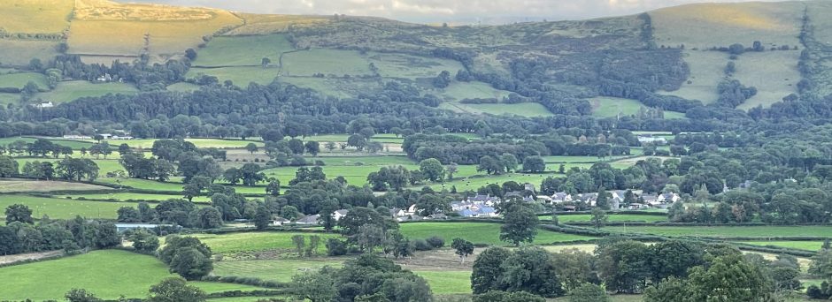
Cwm Rhaeadr is situated in the upper Tywi valley, approximately 1 mile North of Cilycwm. Forest Enterprise, which is an agency of the Forestry Commission, manages these woodlands on behalf of the National Assembly of Wales.
A minor council road leads right to the forest entrance where there is a small car park and picnic site. There are a number of permissive walks, including a 2 mile waymarked route, which lead from the entrance, and there is also a network of public footpaths leading through the forest and out onto Mynydd Mallaen.
The old farm buildings and open fields located beyond the waterfall, which gives the forest its name, are leased to the Scouting organisation. The forest is open to walkers, cyclists and soon to horse riders. Care will be required by horse riders so as to avoid riding on permissive and public footpaths and thus avoid potential damage to surfaces.
The total woodland area is 144 hectares , with a species composition as follows: –
Douglas fir – 37 ha – 25%
Larches – 31 ha – 22%
Sitka spruce – 14 ha – 10%
Norway spruce – 22 ha ) – 15%
Pines – 1 ha – 1 %
Broadleaves – 10 ha – 7%
Open space – 15 ha – 10%
Felled areas – 14 ha – 10
1 Hectare = 2.47 Acres
The forest has had a number of felling coupes in recent years resulting in multi-aged crops. The current design plan identifies large areas of the mature Douglas fir stands for managed retention, particularly around the picnic site and adjacent to the forest walks. Norway spruce and Larch stands will be felled in small to medium sized coupes with a minimum gap between adjacent fellings of seven years. Replanting will where appropriate mean the move from conifer stands to broadleaf planting. Many of the retention areas will gradually revert to broadleaves and where appropriate conifer stands will be regenerated naturally.
The Cwm Rhaeadr project aims are:
to improve access to and safety within the forest to encourage more visitors and
give greater enjoyment;
to improve knowledge of woodlands and wildlife and their management
to increase broadleaf trees, especially indigenous oaks
and to increase awareness among the local community and the wider public that Cwm Rhaeadr exists.
Its main activities will be:
creating a new circular All Ability Access Trail with pond and butterfly glade creating a new Mountain Bike Route (Family Fun Ride/circular cycle route in the forest)
creating a bridleway through Cwm Rhaeadr that links onto Mynydd Mallaen’s existing bridleway
improving the existing forest walk with slip repairs, seats, waymarkers, stiles to the waterfall, interpretation and map boards
improving the existing car park and access point
a Scouts’ orienteering course
involving local people in doing surveys of wildlife, trees, and plants; putting up bird boxes; and designing interpretation boards, information leaflets, and walk leaflets
organising guided nature walks
collecting ideas on short and long term re-planting within Cwm Rhaeadr to submit a plan to feed into Forest Enterprise planning, and approaching Crown Commission about preserving ancient oak woodland on Mallaen slopes
marketing and publicising the project
It will benefit people with disabilities, older people, families with young children, cyclists, riders, bird watching, wildlife enthusiasts, residents from upper Tywi, visitors and holiday makers.
Top
Map of proposed developments
Key
Management area
Permissive Bridleway
All ability trail
Built cycle trail
Existing forest walk
Existing forestry road
Road to Rhandirymywn
To Cilycwm
Top
Environment Impact Assessment
Information compiled by Martin Murray. Countryside Recreation Officer. Carmarthenshire County Council Reasoning behind the Assessment.
To assess the Environmental impact of the Cwm Rhaeadr Community Woodland Project. To determine the validity of such a scheme in terms of the possible ensuing environmental damage.
Restrictions:
The time available for an assessment is limited due to practical considerations for completing the physical works on the ground within the year (2004).
A full Flora and Fauna survey cannot be done due to point one above and financial constraints. Given the above, several key points should be noted: That the assessment done to date and the planned monitoring of the new paths and trails as clearance and construction work progresses, meets if not exceeds the normal good practice carried out for similar works in other woods owned and managed by Forestry Commission Wales.
A number of people with specialist and/or local knowledge have done site visits to assist with plant and animal surveys and to help assess the viability of the scheme.
Forest Commission Wales staff who are familiar with the site, along with independent surveyors have not raised any major concerns relating to the implementation of the scheme, if due consideration is paid to the concerns raised and advice outlined below.
Timing and implementation of works on the ground.
From a practical point of view it is recognised that it is preferable to do the work during the height of summer as this allows for the best ground conditions for any heavy machinery. However, there are problems with this, and a compromise will have to be found between doing the work in midsummer and holding off until the winter with the consequent problems of wet weather and short daylight hours. If possible all heavy machine work should be held off until late July or August.
Nesting Birds.
Goshawks are of particular note within this woodland and it is highly likely that other raptors use the woodland to nest or roost. At the time of writing the Goshawks had not returned to their previous nest sites. This would have conveniently placed them a good distance from the intended work and any new development. It will therefore be necessary to check all potential Goshawk nesting sites along the intended routes before work begins. If a nest is found, works will need to be suspended in that area until the young have fledged and flown the nest.
The area proposed for the construction of the All Ability Trail will be in a section of woodland that has considerable coverage of Bramble, self-seeded Birch, Willow and Hazel. This forms a dense and in some places almost impenetrable under-storey and shrub layer. This habitat is important as it provides cover, nesting sites and feeding areas for a variety of birds such as Dunnock, Robin, Wren and Blackbird. These areas should remain undisturbed until after the nesting season. F.C.W. should consider retaining some of this dense, scrubby under-storey (perhaps 50%) to maintain the habitat into the future and also to provide added interest for visitors as one of a variety of habitats within the All Ability Trail area. (This and other habitats could be the subject for interpretational information for the public.)
Badgers
One hole was found within the all ability access area. It was difficult to tell whether this was still in use, and if it was, by what animal. (Alan Enoch F.C.W. Conservation Ranger took Grid Ref. for this) What appeared to be badger runs where found in the vicinity, as were badger droppings but this may only denote a feeding and/or latrine area. However, erring on the side of caution and taking the trail approx. 20m to one side of this is advisable.
Top
Other issues in the All Ability Access Trail Area.
Thinning of Douglas Firs.
Much of the above mentioned bramble and scrubby understorey lies beneath a stand of semi-mature Douglas fir. Retaining this stand is important from a conservation and aesthetic point of view as it adds to the diversity of the area. However, thinning out and felling some of the poorer trees would improve the appearance by giving the remaining Firs space to fill out and show their true stature.
ForestCommissionWales Staff would need to be consulted on the practicality of this as they are best placed to assess the potential damage to the stand and danger to the public due to wind throw.
Pond/Wetland area.
The pond shown on the F.C.W. map is a distinct habitat in its own right with its associated wetland plants and animals. Any damage to this area should be avoided, as it is arguably the most interesting site within the All Ability Access Trail area. It is not so much a pond at present as a wetland area and could easily be improved by enlarging it and creating open water areas (probably on its north-west side). This could be done at the same time as the path construction.
NB. If the pond/wetland area is to be improved it should be enlarged leaving the existing flora undisturbed and not dug out. If it is found necessary at any point to remove the wetland vegetation/soil it should be put to one side and then put back within the wetland area as soon as reasonably possible to retain the seed base and insect life.
Enlarging the pond and creating open water areas would improve the habitat for Dragonflies and Damselfly flies and can only add aesthetic value and interest to the trail. A carefully constructed boardwalk could cross or skirt part of the wetland area to get visitors closer to the different plants and animals without too much damage to the habitat (as a boardwalk would only need to be 1.2m wide.) A fringe of native shrubs should, where they exist, be left in place (or planted as necessary) to create partial shade on one side of the pond and most of the conifers removed on the other sides to let in more light. The creation of an open glade by removal of the conifers would provide the necessary light and benefit the surrounding ground flora. It would also make an ideal spot for seating and interpretation.
The Open Glade.
Creating and maintaining an open glade in the northern section (as suggested on the F.C.W. plan) will create another distinct habitat and will add to the diversity and interest of the site. Concerns over the management of this area have been raised and the stated management regime of flailing the area in order to suppress or eradicate the bracken will need to be adhered to.
Any general spraying with herbicides should be avoided. Any persistent invasive species like Rhododendron should be “spot” treated with a systemic herbicide.
Top
Other issues relating to the rest of the woodland.
The Cycle Track.
The cycle track appears to overlie the line of the public Right of Way along two of its sections.
The contractors will need to ensure that the Cycle Track is constructed to one side of the R.O.W. to avoid any conflict with walkers and to avoid illegal use of the path.
Increased visitor pressure.
Concerns have been raised about the effects of increased visitor pressure on the woodland and indeed the surrounding area. My personal belief is that the development is unlikely to attract excessively large numbers of visitors at any one time. I think it probable that visitor numbers will be spread throughout the year with the obvious exceptions of holiday times and weekends during fine weather. A purpose built attraction like this should easily accommodate the number of visitors likely to turn up, even at peak times. One of the finer things about developments within forests is that large numbers of visitors can be accommodated without a sense of overcrowding. I do not believe that visitor numbers will have too detrimental effect on the flora and fauna of the area, although it has to be recognised that some disturbance is inevitable.
The Waterfall and the Public Right of Way.
Increased visitor pressure to the waterfall site is a concern that will need to be addressed. This is a sensitive area where the flora would be easily damaged by trampling. At present the Public Right of Way leads up the southern side of the waterfall. It is probably a mapping error and needs changing, as the line is practically impossible to follow without risk of personal injury. This problem needs discussing with Carmarthenshire County Council’s Rights of Way Officer (Bruce Wallace). A diversion to the north side of the waterfall leading onto the moor seems a sensible solution to provide a safe alternative for walkers. This also provides the added benefit of lessening the damage to the flora in this sensitive area. Because of the Health and Safety issues Carmarthenshire County Council may be persuaded to cover the associated legal costs.
Wood Horsetails.
A concern has been raised about the increased use of the existing routes within the woodland. A number of Wood Horsetail (Equisetum Sylvaticum) grow on the southwest section of the blue path, immediately north of the bridge. This is a notable species, uncommon in the area that deserves protection. My personal belief is that the effects of trampling on this species will not be as significant as the mowing/strimming regime along the edge of the path. The horsetails grow mostly in the drainage ditch and the adjacent bank and will be largely untouched by passers by.
F.C.W. staff are advised to consult with James Iliff regarding the management of this section of path.
Motorbikes and 4×4 Motor vehicles.
Efforts will need to me made to exclude 4×4 off roaders and motorbike riders, whilst still allowing easy access for horse riders, walkers and cyclists. 4 x 4 vehicles and scramblers are capable of creating an enormous amount of damage in a very short time. This will be especially true if they gain access to Mynedd Mallaen SSSI.
It is possible to construct motorbike barriers (An example is illustrated in the BTCV Practical Handbook on Footpaths.) that still allow access for horse riders, walkers and cyclists. The barriers are not 100% proof against a determined motor-biker, but should significantly reduce the problem.
Forest Enterprise will no doubt want to address this problem.
Footpath materials
Where and if practicable, path surfacing materials should be used that match the PH values of the surrounding soils. It is recognised that achieving this may be unrealistic due to availability or costs of materials and transport.
Top
The Way Forward.
It rapidly became clear in the course of site surveying that it would be virtually impossible to follow the intended line of the new paths and tracks. As mentioned above some areas are impenetrable due to bramble and branches, a walking survey of the exact line of the tracks was therefore impossible.
The common consensus of opinion was that a sensible and sensitive approach would be, to clear the line of the new paths and tracks of all brash and bramble prior to introducing heavy machinery. Once this is achieved a final check can be made along the proposed route, which may then be re-aligned if anything is found to justify an alteration, e.g. a badger sett, a rare plant or a habit worth conserving.
This I understand is common practice for Forest Commission Wales. It would seem that the best person placed to carry this out would be the F.C.W. Conservation Officer for the area (Dave Reece) perhaps supported by one or more of the local surveyors/recorders who have kindly offered their help (James Iliff and Neil Matthew).
Summary
It is my firm belief that a carefully managed development of the type proposed would provide a popular attraction for residents in the locality. Equally importantly it would attract tourists from outside of the area, this in turn would help to support and sustain the rural economy. It also has the potential to improve the existing habitats within the woodland and therefore increase the diversity of the flora and fauna. The proposed heavy thinning, brashing, pruning and replanting may well improve many of the areas that have been under deep shade, cast by conifers.
Remnant plant communities associated with mixed broadleaved woodland and moorland still survive in the sunnier areas, in small glades and along the edges of rides. The opening up of the woodland along the line of the new trails and the subsequent scarification due to footpath construction works may well assist the spread and re-growth of these remnant plant communities. Some seeds can survive many years in the ground, so it will be interesting to see what plants return with the return of the light and a little bit of disturbance.
Remnant plant communities associated with mixed broadleaved woodland and moorland still survive in the sunnier areas, in small glades and along the edges of rides. The opening up of the woodland along the line of the new trails and the subsequent scarification due to footpath construction works may well assist the spread and re-growth of these remnant plant communities. Some seeds can survive many years in the ground, so it will be interesting to see what plants return with the return of the light and a little bit of disturbance.
Action will need to taken, to address the issues and concerns raised, but I am confident that the project can, and will be, implemented in an environmentally sensitive way that, on balance, will prove beneficial to both people and the environment.
Acknowledgements
I would particularly like to thank:
James Iliff (local botanist and recorder/surveyor) and Mary Iliff who freely volunteered their time and assisted with site visits and survey work. Their local knowledge and botanical expertise was much appreciated.
Neil Matthew working for CCW who provided information during a site visit on the animal and plant life of the area.
The staff of Forest Commission Wales (Llandovery Office) who found time to freely discuss the project and provided maps and other information about Cwm Rhaeadr wood.