CARMARTHENSHIRE: TYWI VALLEY
HISTORIC LANDSCAPE CHARACTER AREA:
217 CWM-Y-RHAEADR GRID REFERENCE: SN 765435
AREA IN HECTARES: 246.40
Historical Background
A small area on the steep eastern flank of Mynydd Malláen, lying within the former Cwmwd Malláen of Cantref Mawr which remained an independent Welsh lordship until 1284, and largely retained native systems of tenure throughout the Medieval period. It also lies within the ecclesiastical parish of Cilycwm which may have later Medieval origins in the 14th century (Ludlow 1998). The area has little contemporary settlement, which reflects its historic usage; however, the name ‘Dinas’ may represent an Iron Age hillfort for which there appears to be no physical evidence. The area is depicted as open pasture on the earliest historic maps and is still largely unenclosed, and the presence of a sheepfold testifies to its predominantly pastoral use. Such farmsteads and enclosures as exist mainly relate to 18th- and early 19th-century encroachment into former open land. There is a small former lead mine on the eastern edge which may have early origins. Mining was being undertaken in this area by the late 13th-century, the crown taking the ‘eleventh foot’ of the ore in taxation (Rees 1968), but had largely ceased by the late 19th-century. Much of the area has been subject to later 20th century conifer plantation under the (then) Forestry Commission.
Description and essential historic landscape components
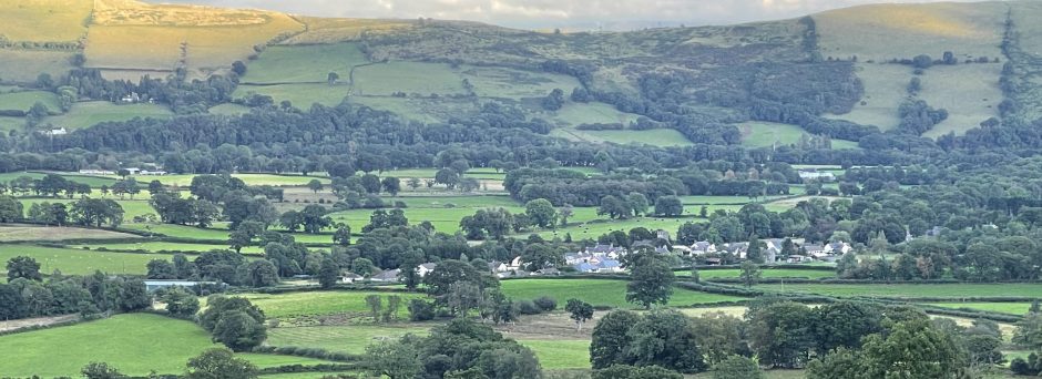
This character area lies on the steep valley sides of the Tywi and its tributaries. The height range of this area is between 140 m and over 300 m. Apart from a little deciduous woodland on lower slopes, some open moorland on steep slopes, and an old small farmstead – Cwm-y-Rhaeadr – with a few adjacent fields, this whole area is under 20th century conifer plantations. Most of these plantations were established on unenclosed moorland on the steep valley sides. The only exception to this is at and around Cwm-y-Rhaeadr where former fields were planted over.
There is little recorded archaeology, being confined to the possible Iron Age hillfort site, the lead mine and buildings.
None of the buildings are distinctive, comprising 19th century cottages and farms, a sheepfold and 20th century water towers.
This is a distinct area, and stands in contrast with the open moorland (Area 247) to the west and enclosed farmland to the south, north and east (Areas 215, 216 and 218).
Conservation priorities
There are no historic landscape conservation priorities in this area.
- Ground photograph: 83
- Aerial photographs: 4
The following sites are recorded in the Sites and Monuments Record for this area.
| PRN | Name | Grid Reference | Site Type | Period |
|---|---|---|---|---|
| 7,864 | DINAS FAWR LEVEL | SN77044328 | METAL MINE-LEAD | Post Med |
| 13,748 | MYNYDD MALLAEN | SN758438 | COMMON LAND | Medieval;Post Medieval |
| 13,789 | MYNYDD MALLAEN | SN757432 | COMMON LAND | Medieval;Post Medieval |
| 21,845 | PEN-CORN-HWRDD | SN77134297 | COTTAGE? | Post Med |
| 21,846 | TY-COCH | SN76704253 | COTTAGE? | Post Med |
| 21,848 | CWM-LLAFROD | SN76454319 | DWELLING | Post Med |
| 29,564 | CEFN HIGHGATE | SN76564360 | DWELLING | Post Med |
| 29,566 | SN76264308 | DWELLING? | Unknown | |
| 29,567 | CAE’R CEFFYL | SN76314296 | DWELLING? | Post Med |
| 30,185 | PWLL-YR-HYDDOD | SN76834246 | DWELLING | Post Med |
| 30,186 | LLETHR-GWYN | SN76834285 | DWELLING | Post Med |
| 30,187 | CRAIG-Y-RHAIADR | SN75984361 | DWELLING | Post Med |
| 30,188 | SN75884312 | DWELLING | Post Med |
YMDDIRIEDOLAETH ARCHAEOLEGOL DYFED CYF / DYFED ARCHAEOLOGICAL TRUST LTD.
Neuadd y Sir Caerfyrddin,Llandeilo,
Sir Gaerfyrddin, SA19 6AF. The Shire Hall,
Llandeilo,
Carmarthenshire,
SA19 6AF. Ymholiadau Cyffredino/Tel 01558 823121 – 823131
Ebost/email:cambria@acadat.com
The Trust is both a Limited Company (No.1198990) and a Registered charity (No.524616)